
-
AGRICULTURAL MACHINERY
- BRANDS
- Tractors CASE IH
- Grain-harvesting combines
-
Sowing machinery
- KUHN Planter 3 Select precision seed drill
- Sowing complex KUHN ESPRO _ RC
- Precision seeder KUHN KOSMA
- Case IH SDX 30/40 pneumatic sowing machine
- BEDNAR OMEGA OO FL sowing machine
- A wide seed drill BEDNAR EFECTA CE
- Grain seeder BEDNAR CORSA CN
- Pneumatic precision seed drill KUHN MAXIMA 3 TRM E
- MATADOR MO sowing machine
- Rear-Mounted hunter for fertilizer application BEDNAR FERTI-BOX FB
- Sprayers
- Tillage machinery
-
Harvesting machinery
- Olimac Drago 2 corn harvester
- Olimac Drago GT corn harvester
- Olimac Gold sunflower harvester
- Franco Fabril SF sunflower harvester
- Case IH 3020 TeraFlex
- Case IH Grain harvesters
- Case IH 3050 Varicut
- MacDon FD2 corn harvesters
- Grain reaper Case IH 2030
- Case IH 4408 corn harvester
- Case IH 4412 corn harvester
- PW8 Pick-up Header
- Corn harvester FRANCO FABRIL MH870
- Mower
- Balers
- Rollers
- Telescopic loader
- USED Machinery
- SAFEGUARD WARRANTY
-
PRECISION AGRICULTURE
- AgroDrones & UAV
-
Tractor solutions
- Raven CR7 Field Computer
- XCN - 2050 display
- Дисплей XCN-1050
- XCN-750 display
- Autopilot Electric Motor Drive automatic driving system
- Automatic driving system EZ-Pilot Pro
- AFS AccuGuide precision farming system
- Automatic water system T-Line
- Raven hydraulic autopilot for unprepared equipment
- Trimble Autopilot automatic control system
-
Sprayer solutions
- Raven RS1 ven autopilot for prepared equipment
- HAWKEYE 2 drop ejection and quality control system
- Automatic height control of the AutoBoom XRT sprayer
- Sidekick Pro direct injection system
- VSN visual driving camera
- Hawkeye HD sprayer nozzle control system
- AI-system spot spraying Carbon Bee Smart Sticker X
- Combine solutions
- Trailed implements solutions
- Correction service
- Maintenance of data
- USED MACHINERY
- SERVICE
- PARTS
- WORK AT TITAN
- SPECIAL OFFERS
REMOTE SOUND SENSING™
Choice of satellite
Each specific task requires an individual approach to obtain the optimal result. Many tasks can be solved using free pictures, but some key features need to be paid for, and here you need to find a balance between price and quality of shooting.
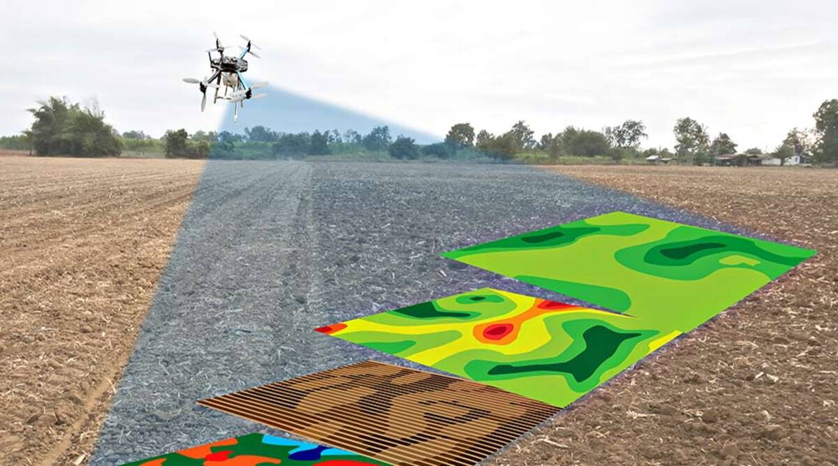
Processing of satellite images
A wide range of steps from ordering and downloading to per-channel correction and registration of the classification of satellite images, which aims to provide the most complete tools for remote sensing of the earth.
Data collection, design, conversion
Everything created in electronic format can be archived, reformatted, edited and converted according to the specifications of the customer
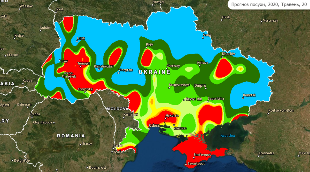
Identification of problem areas on homogeneous crops, using vegetation indices
No problem area on the field will hide from you, regardless of the location on the field and the distance of the office.
Each specific task requires an individual approach to obtain the optimal result. Many tasks can be solved using free pictures, but some key features need to be paid for, and here you need to find a balance between price and quality of shooting.
Processing of satellite images
A wide range of steps from ordering and downloading to per-channel correction and registration of the classification of satellite images, which aims to provide the most complete tools for remote sensing of the earth.
Data collection, design, conversion
Everything created in electronic format can be archived, reformatted, edited and converted according to the specifications of the customer
Identification of problem areas on homogeneous crops, using vegetation indices
No problem area on the field will hide from you, regardless of the location on the field and the distance of the office.
TITAN MACHINERY UKRAINE qualified specialists are trained by our European partners on the regular basis. We are ready to provide you with professional support together with choosing the best solutions for your working conditions.
We are ready to provide all the information about the machinery presented on our website.
Please contact us by the number or e-mail: 0800-50-8080 / sales@titanmachinery.ua
Please contact us by the number or e-mail: 0800-50-8080 / sales@titanmachinery.ua
INDUSTRIES
BRANDS